The Effects of Land Use Change on the Some Soil Properties In Gbonyin Local Government Area of Ekiti State, Nigeria
Adebayo Williams Oluwole 1 and Olofin E. O 1
1Department of Geography and Planning Science, Ekiti State University, Ado – Ekiti, Nigeria .
http://dx.doi.org/10.12944/CRJSSH.1.2.04
Copy the following to cite this article:
Oluwole A. W, Olofin E. O. The Effects of Land Use Change on the Some Soil Properties in Gbonyin Local Government Area of Ekiti State, Nigeria. Current Research Journal of Social Sciences and Humanities 1(2). DOI:http://dx.doi.org/10.12944/CRJSSH.1.2.04
Copy the following to cite this URL:
Oluwole A. W, Olofin E. O. The Effects of Land Use Change on the Some Soil Properties in Gbonyin Local Government Area of Ekiti State, Nigeria. Current Research Journal of Social Sciences and Humanities 1(2). Available From: https://bit.ly/2T5J1gA
Download article (pdf) Citation Manager Review / Publish History
Introduction
Land use changes linked with the anthropogenic and natural factors affect many ecosystems including soil and forest1. Land degradation resulting from various anthropogenic factors has been a major challenge since the 20th century and will remain high on the international agenda in the 21st century2. According3 land degradation is increasing in severity and extent in many parts of the world, with more than 20% of all cultivated areas, 30% of forests and 10% of grasslands undergoing degradation. In recent years increasing amounts of Gbonyin lands have been developed and utilized for agriculture and human settlements. This has significantly impacted the land and altering forest ecosystem in Gbonyin Local Government Area of Ekiti State, Nigeria.
Land degradation affects both biotic and abiotic factors of the ecosystem, including factors like soil and water resources (surface and underground), vegetation, animals and micro-organisms.4, 5, 6 and 2 on the effects of land use change on soil properties showed that, land use change from vegetation land use to built-up land use often leads to reduction of organic matter inputs and nutrients in the soil. Conversion of vegetation land use to another form of land uses such as agricultural and built-up land uses can lead to soil erosion which will eventually, reduced the nutrients in the soil7.
Most of the vegetated areas in the study area have been converted into agricultural and built-up land uses. This has resulted in the degradation of the land in the study area. However, the exact relationship between land use types and soil properties in Gbonyin Local Government Area of Ekiti State has not been well established. This study therefore, set out to examine the effect of land use changes on land degradation as reflected by soil properties such as bulk density, soil organic matter, calcium, magnesium and potassium in Gbonyin Local Government Area of Ekiti State, Nigeria.
The Study Area
Gbonyin Local Government Area of Ekiti State is located between latitudes 70321 and 70401 north of the equator and longitudes 50221 and 50431 east of the Greenwich meridian (see Fig 1.1).
Gbonyin Local Government Area is made up of eleven communities, comprising Aisegba, Agbado, Imesi, Egbe, Ijan, Ilupeju – Ijan, Iluomoba, Ipole Iloro, Iro, Iro- Ayeteju and Ode- Ekiti. Ode- Ekiti is the Local Government headquarter (see Fig 1.1). Other farm- steads in the Local Government Area include Aba Ogundele, Aba Oba, Aba Akawo, Aba Temidire, Abajesin, Aba Kume, Aba Ajeoku, Aba Anifowose, Aba Panu, Ajebamidele, Ita- Aluko and Odiolowo (see Fig 1.1). Immigrants from Kogi, Ondo, Osun and Kwara States, who are mostly engaged in farming activities, populate the Local Government Area.
The study area is characterized by rainforest type of vegetation. Animals in the area include antelope, grass cutters, squirrels, porcupine, monkeys and snakes of all types. The study area is situated in the tropical rain forest region of Nigeria. The area has two distinct seasons- the dry and wet. It has adequate moisture that supports high yielding forest because it received between 1,000mm to 1,800mm of rainfall annually and annual temperature of between 250C to 300C.
The topography of the study area is undulating lowlands. The settlement pattern of the study is linear pattern of settlement because most of the houses in the study area were built along the major roads. Agricultural, residential, transportation and industrial land uses are the major land uses in the study area. The vegetation of the area is of forest type, timber is produced in large quantity in the forest, hence the location of various saw-mills in the following major settlements of the Local Government Area:
i. Agbado- Ekiti;
ii. Aisegba- Ekit;
iii. Egbe- Ekiti;
iv. Ijan- Ekiti;
v. Imesi- Ekiti;
vi. Iluomoba- Ekiti;
vii. Ode- Ekiti.
The study area is characterized by rainforest type of vegetation and to justify the rainforest nature of the study area, table 1.1 shows the list of trees commonly found in the study area.
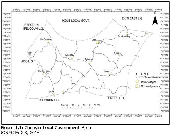 |
Figure 1.1: Gbonyin Local Government Area click here to view figure |
|
S/N |
BOTANICAL NAMES |
|
|
|
Macarange barteri
Tripochiton seleroxylon
Terminlia superb
Newboulolia laevis
Albizzia feruginea
Gynemetra megalophylia
Symphomia gabonesis
Melicia excels
Blighia sapida
Triploclicton scleroxylon
Coraia millenii
Musanga smithii
Irvingia gabonensis |
Araba
Arere
Afara
Akoko
Ayere
Eru
Igi Odan
Iroko
Igi Isin
Obeche
Omo
Oro
Oropa |
Material and Method
Two adjacent land uses (forest and residential) were purposively selected in the research area. Soil samples were collected at ten different locations in each of these land uses at 0 to 30cm depth with the use of soil auger. The twenty soil samples collected were packed in cellophane bags, labeled and well fastened to preserve the moisture before laboratory test.
The result of the laboratory was further analyzed using t-test statistical method to test for significant differences among soil samples in relation to the two different land use types in Gbonyin Local Government Area of Ekiti State, Nigeria.
Experimental Procedure for Determination of Organic Matter
The Empty evaporating dish was weighed. Then, the soil sample was placed into the dish and reweighed. The dish containing the soil sample was heated strongly at a temperature of about 1000 c to remove moisture content. The soil was heated again and stirred with a rod until the organic matter was completely burnt during which the organic matter was converted into gases and escaped into the atmosphere. After heating the dish and the contents were cooled in the desiccators, the contents of organic matter in each of the soil samples were determined with this formula.
Mass of organic matter =mass of dried soil – mass of burnt soil, ---------3.1
The percentage of organic matter in each of the soil sample was also determined using this formula (see appendix IV)
Mass of organic matter X 100 --------------------------------------- 3.2
Mass of dried soil 1
Experimental Procedure for Determination of Bulk Density
The soil samples were burnt at 1050C, cooled in desiccators, weighed on sensitive weighing machine and weight recorded in grams. The bulk density was then calculated based on mass/volume ratio of the bulk density sampling ring and values were recorded (see Appendix V).
Results and Discussion
Two different adjacent land use (residential and forest) types were identified in Gbonyin Local Government Area of Ekiti State, Nigeria. The relationship between land use types and its effects on the some soil properties is the major concern of this study.
In tables 1, 2, 3 and 4 below, a brief description of calcium, potassium, magnesium and soil organic matter concentration in residential and forest land uses are given. This includes the general summary of the mean, the standard deviation, the co-efficient of variability and t-test analysis of soil properties.
Table 1: Summary of the Mean, the Standard Deviation, the Co-Efficient Of Variable and T-Test Analysis Of Calcium Concentration
|
Land use types |
N |
Mean |
Min. |
Max. |
S.D |
C.V (%) |
d.f. |
Tcal |
Ttab |
Decision |
|
Forest |
10 |
55.82 |
|
|
11.31 |
20.26 |
18 |
10.33 |
2.10 |
S |
|
Residential |
10 |
18.34 |
|
|
1.95 |
10.63 |
|
|
|
|
P<0.05 level of significance. S= significance. NS= Non Significant. C.V.=Coefficient of Variation. S.D.= Standard Deviation. d.f.=degree of freedom. Tcal=T-test Calculated. Ttab=Ttest Tabulated.
Table 2: Summary Of The Mean, The Standard Deviation, The Co- Efficient Of variability And T-Test Analysis Of Potassium Concentration
|
Land use types |
N |
Mean |
S.D |
C.V% |
d.f. |
Tcal |
Ttab |
Decision |
|
Forest |
10 |
58.04 |
14.61 |
25.17 |
18 |
7.77 |
2.10 |
S |
|
Residential |
10 |
21.79 |
2.02 |
9.27 |
|
|
|
|
P<0.05 level of significance. S= significance. NS= Non Significant. C.V.=Coefficient of Variation. S.D.= Standard Deviation. d.f.=degree of freedom. Tcal=T-test Calculated.Ttab=Ttest Tabulated.
Summary of The Mean, The Standard Deviation, The Co-Efficient Of Variable And T-Test Analysis of Magnesium Concentration
|
Land use types |
N |
Mean |
S.D |
C.V% |
d.f. |
Tcal |
Ttab |
Decision |
|
Forest |
10 |
58.53 |
8.83 |
15.09 |
18 |
14.32 |
2.10 |
S |
|
Residential |
10 |
16.63 |
2.75 |
16.53 |
|
|
|
|
P<0.05 level of significance. S= significance. NS= Non Significant. C.V.=Coefficient of Variation. S.D.= Standard Deviation. d.f.=degree of freedom. Tcal=T-test Calculated. Ttab=Ttest Tabulated.
Table 4: Summary of The Mean, The Standard Deviation, The Co-Efficient Of Variable And T-Test Analysis of Organic Matter Concentration
|
Land use types |
N |
Mean |
S.D |
C.V% |
d.f. |
Tcal |
Ttab |
Decision |
|
Forest |
10 |
7.79 |
1.79 |
22.98 |
18 |
11.93 |
2.10 |
S |
|
Residential |
10 |
0.67 |
0.58 |
0.87 |
|
|
|
|
P<0.05 level of significance. S= significance. NS= Non Significant. C.V.=Coefficient of Variation. S.D.= Standard Deviation. d.f.=degree of freedom. Tcal=T-test Calculated. Ttab=Ttest Tabulated.
From Tables 1, 2, 3, and 4 the means and standard deviations of soil chemical properties concentration are seen to be differed with the variables in forest land use generally showing higher values than the variables in residential land use. For instance, the mean concentration of calcium in forest land use is 55.82 while it is 18.32 in residential land use. These similar trends were applicable to potassium, magnesium and soil organic matter
The summary of the t-test in tables 1,2,3, and 4 reveal the differences in the concentration of soil chemical properties in the forest and residential land uses. For instance, the t-test analysis for calcium concentration showed that the Tcal (10.33) was higher than Ttab (2.10) at 0.05 level of significance which implies that there is significance difference in the calcium concentration between forest and residential land uses in Gbonyin Local Government Area of Ekiti State. These similar trends were an application to potassium, magnesium and soil organic matter.
Table 5: Summary of The Mean, The Standard Deviation, The Co-Efficient Of Variable and T-Test Analysis of Bulk Density
|
Land use types |
N |
Mean |
S.D |
C.V% |
d.f. |
Tcal |
Ttab |
Decision |
|
Forest |
10 |
0.94 |
0.59 |
8.13 |
18 |
11.49 |
2.10 |
S |
|
Residential |
10 |
7.26 |
1.64 |
22.59 |
|
|
|
|
P<0.05 level of significance. S= significance. NS= Non Significant. C.V.=Coefficient of Variation. S.D.= Standard Deviation. d.f.=degree of freedom. Tcal=T-test Calculated. Ttab=Ttest Tabulated.
The summary of the t-test in Table 5 reveals the different in the soil bulk density in the forest and residential land uses of the study area. The mean value in residential land use (7.26) was higher than the mean value of forest land use (0.94). The t-test analysis showed that the Tcal (11.49) was greater than Ttab (2.10) at 0.05 level of significance which implies that there is a significant difference in the soil bulk density between forest and residential land uses of Gbonyin Local Government Area of Ekiti State. This implies that the concentration of soil bulk in the residential land use of the study area is higher than that of the forest land use of the study area.
The changes in land use types experienced in Gbonyin Local Government Area of Ekiti State may be as a result of an increase in human population, forcing encroachment of forest land for human settlement. In concord with the current findings, previous studies such as8and9 show that change in land use types is highly dependent on the indiscriminate exploitation of environmental resources to meet the immediate needs of the people living in such environment without considering the long-term effect on the soil.
Good numbers of researchers, including10 and 11 agreed that most of the changes observed in land use in many parts of Africa, are majorly associated with urbanization and extension and of agricultural activities to new areas. The current findings showed that most plots within Gbonyin Local Government Area of Ekiti State sampling sites that had undergone changes in land use were initially vegetated land use before they were converted to agricultural and built-up land uses.
Like the current study12 while studying the relationship between land use change and land degradation in East Africa, reported that land use change has transformed land cover to farmlands, grazing lands and human settlement at the expense of natural vegetation. These changes are associated with environmental degradation such as deforestation, biodiversity loss and loss of soil nutrients. In the current study, high bulk density and low soil organic matter observed at the residential land use could have been as a result of conversion of forest land to residential land which together with poor farming system might have had an impact on the soil structure thus, increasing the bulk density and reducing the chemical properties of the soil and subsequently contributed to land degradation.
Conclusion
Based on the findings from this study, it was presumed that land use changes in Gbonyin Local Government Area of Ekiti State have an effect on soil physico-chemical properties, as exhibited by the differences in soil samples collected at different locations in the study area. This phenomenon can also explain the reasons for low chemical properties of the soil in residential land use as opposed to high chemical properties of the soil and low bulk density in forest land use in the study area. The findings of this study will point to the need to have concentrated policies on integrated soil and forest resources management in Gbonyin Local Government Area of Ekiti State, Nigeria.
Acknowledgements
I want to use this medium to acknowledge the support of my Ph. D. Thesis supervisor in the person of Professor ADEBAYO, Williams Oluwole who out of tight schedule, he find time to proofed this manuscript. I really appreciate your effort sir. I also appreciate all the authors cited in this work.
Funding Source
The source of fund for this research work is myself. So, there is NO conflict of interest.
Conflict of Interest
No conflict of interest in this work.
References
- Jones , K.B; Nash, M.S And Wade,T .G. (2010). Rapiran Habitat Changes Across the Continental United States. (http://dx.doi.org}. Retrieved on 12th march, 2015.
- Emaid, M; Baghernejad, M. and faith, H. (2008). Effect of Land Use Change on Selected Soil Physical and Chemical Properties in North Highland of lran. Journal of applied sciences 18(2): 496-500.
- Bai, Z.G;Dent, D.L and Olsson, L. (2008). Proxy Global Assessment of Land Degradation and Soil Management (http://dx.doi.org). Retrieved on 12th March, 2015.
- FAO. (2005). Global Forest Resources Assessment 2005. Progress Toward Sustainable Forest Management (http:www.un.org\earthwatch/forest). Retrieved on 24th March, 2015.
- Agoume, V. and Birang, A.M. (2009). Impact of Land –Use System on Some Physical and Chemical Soil Properties of an Oxisol in the Humid. Tropicultura journal. 5(27):15-16.
- Gol, T. (2009). Effect of Land Use change on Soil Properties and Organic Carbon at Dagdami River Catchment in Turkey. Journal of Environmental Biology.30(2). 825- 830.
- LVBC. (2007). Regional Trans boundary Diagnostic Analysis of Lake Victoria Basin. Kasumu. Lake victoria Basin Commission Publications. 231-234.
- Misana, S.B; Majule, A.E. and lyaruu, H.V. (2003). Linkages between Changes in Land Use, Biodiversity and Land Degradation on the Slopes of Mount Kilimanjaro,Tanzania. LUCID Working Paper No. 38. International Livestock Research Institute, Nairobi.
- Olofin, E.O. and Adebayo, W.O. (2017). Effects of Deforestation on Land Degradation. Saarbrucken, Germany. LAMBERT Academic Publishing, 63.
- Mugisha, S. (2002). Root Causes of Land Use Change in Uganda. (www.lucideastafrica.org). Retrieved on 24th March, 2015.
- Olson, J.M; Misana, S.B. and Campbell, M.J. (2004). The Spatial Pattern and Root Causes of Land Use Change in East Africa. (www.lucideastafrica.org). Retrieved on 24th March, 2015

This work is licensed under a Creative Commons Attribution 4.0 International License.